Aegaea

Quick links

↑ ↓ to choose · Enter to open · Esc to closeSearch stays in your browser.

Case Study3 min readNick Darling-Drewett

Permission Secured After Successful Appeal in Petersfield

Aegaea provided a detailed Flood Risk Assessment (FRA) and SuDS drainage strategy to support an outline planning application for a hotel and cycle centre near Petersfield. Following refusal by the South Downs National Park Authority (SDNPA), our ongoing technical input was instrumental in securing planning permission at appeal.
Case Study: Permission Secured After Successful Appeal in Petersfield

Project in brief

Appeal decision

Petersfield, South Downs National ParkA hotel and cycle centre

The question
Respond to flood risk and drainage matters following refusal of the outline proposal.
Our work
Flood risk assessment, SuDS strategy and technical evidence informed by revised mapping.
Reported outcome
The Planning Inspector allowed the appeal, with detailed drainage matters capable of being secured by condition.
On this page

Project Overview

The proposed development, a hotel and cycle centre, was located on the edge of Petersfield within the South Downs National Park.

As part of the outline application, Aegaea prepared a Flood Risk Assessment (FRA) and a surface water drainage strategy.

The application was initially refused by the South Downs National Park Authority, partly due to the proposed footprint and a SuDS detention basin being located within an area identified as being at risk of flooding, despite it being noted that this risk would be designed out as part of a detailed levels design at Reserved Matters stage.
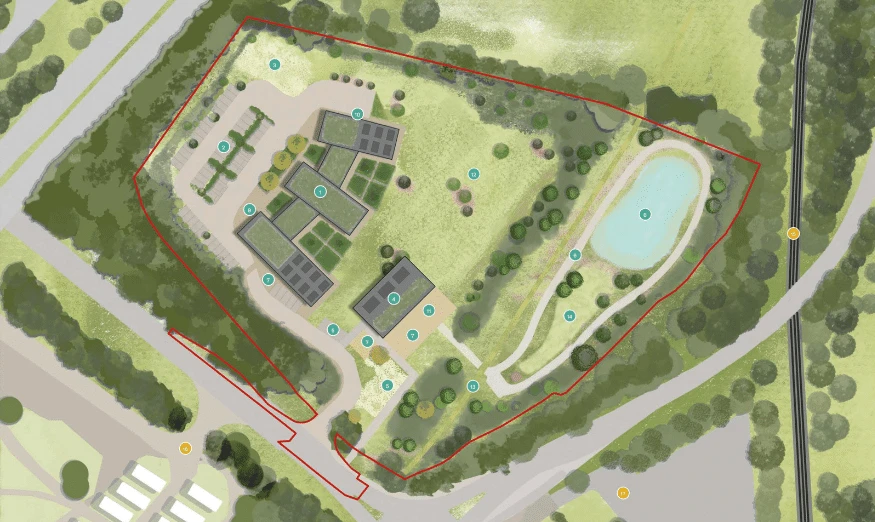
Aerial 3D visualisation of a proposed eco-development featuring green-roofed buildings, footpaths, trees, open green space, a wildlife pond, and surrounding woodland.

Aegaea’s Approach

After the application was refused, Aegaea was appointed to prepare a rebuttal statement for the appeal.

Our response centred on the updated January 2025 National Flood Risk Assessment 2 (NaFRA2) surface water maps.

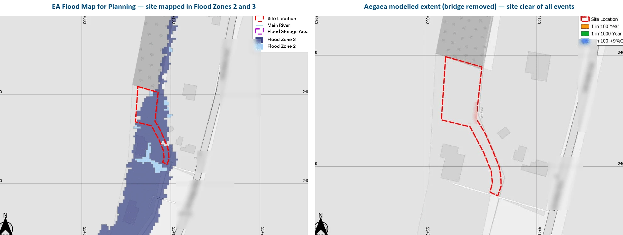
The revised NaFRA2 mapping showed a significant reduction in flood risk across the site, indicating no remaining risk to the proposed buildings and only negligible risk to the SuDS storage basin.

We presented this updated evidence at the appeal hearing, working alongside other technical specialists.

Our clear and robust case demonstrated to the Planning Inspector that a suitable drainage solution could be delivered within the submitted plans, and that the very low surface water risk could be effectively addressed through planning conditions and detailed design at a later stage.
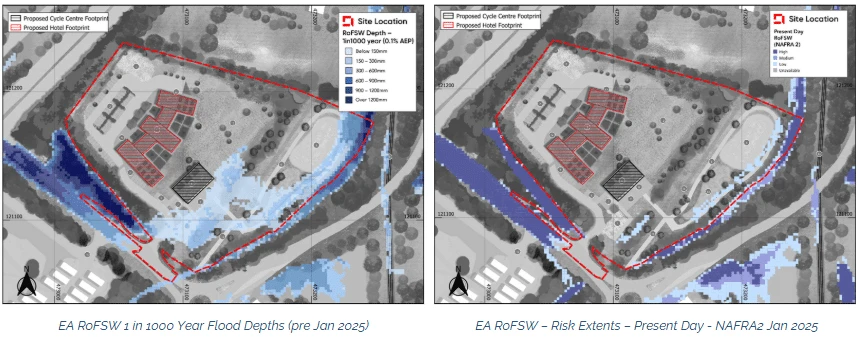
Side-by-side flood risk maps showing the proposed site layout and predicted surface water flood depths under 1000-year event and present-day conditions, with key site boundaries marked in red.

The Outcome ✅

The Planning Inspector allowed the appeal.

In the decision report, the Inspector acknowledged the updated mapping and confirmed that surface water risk was now very low.

The Inspector concluded:

“Whilst a 1:1000 year risk is very low, the appellant claims that recent revision of the flood mapping has seen it removed. Additional attenuation measures that could, if still deemed necessary, be incorporated as part of a detailed site drainage scheme have otherwise also been identified. This could be achieved within the parameters set by the submitted plans, and secured by condition. It is thus a matter that can be resolved at a later stage whether or not a very low risk of surface water flooding still exists.”

“For the reasons outlined above I conclude that a suitable surface water drainage scheme could be implemented, and that in this regard the site is a suitable location for the proposed development. It would therefore comply with Policy SD49 of the Local Plan which generally seeks to secure development that reduces the impact and extent of all types of flooding, and Policy SD50 of the Local Plan which seeks to ensure no net increase in surface water run-off.”

The successful appeal outcome highlights the value of up-to-date flood modelling, technical clarity and expert input in overcoming planning obstacles related to flood risk and drainage.

Having an expert on your team means staying informed about the latest policy and mapping changes, and being able to unlock the development potential of your site.
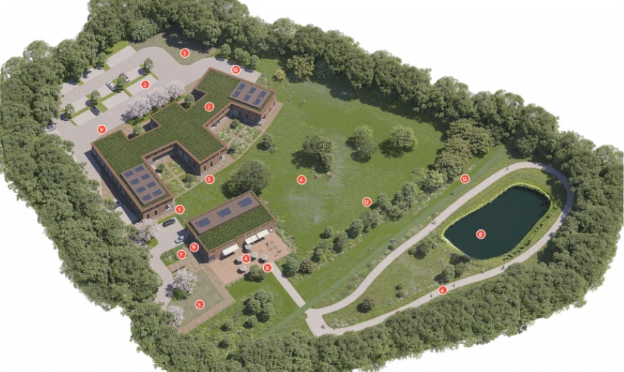

3D aerial visualisation of an eco-development surrounded by woodland, featuring green-roofed buildings, landscaped paths, open green space, and a pond

Written and reviewed by

Nick Darling-Drewett

Consultancy Manager and Lead Flood Risk Consultant · BSc MCIWEM AMIEnvSC

I am a Member of the Chartered Institution of Water and Environmental Management (CIWEM) and an Associate Member of the Institution of Environmental Sciences (AMIEnvSc).

View profile →LinkedIn ↗

↑ Back to top

Case studies

Talk to us about your project

If this raises questions about your own site, we can help you work through them. Share your plans and any comments from the council, and we’ll send a free, no-obligation quote.

Newsletter

Stay ahead of flood risk and planning changes

  • Policy and flood map changes, explained in plain English
  • Practical guidance for your next planning application
  • New projects and lessons from our consultants

No spam. Unsubscribe any time. By signing up, you agree to receive our newsletter and occasional updates. See our privacy policy for how we use your data.

Read the latest update →

Preview: signup not connected yet.