Project Overview
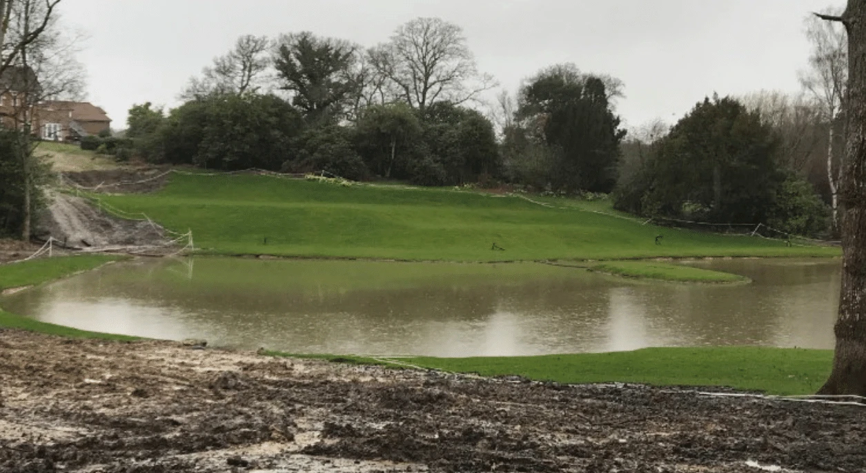
The client in this instance had excavated a larger pond in place of an existing pond, with the construction of an associated embankment to facilitate the impoundment of the larger volume of water. This had been done without planning permission, hence the Local Planning Authority (LPA) served an enforcement notice to the client.
The existing/ pre-development pond, was fed by a small ditch which flowed through the site. The pond was enlarged beyond the pre-development state.
Due to its location on an existing ditch, the area was defined as being at risk of pluvial (surface water) flooding as per the EA’s Risk of Flooding from Surface Water (RoFSW) dataset. Due to the nature of the scheme as a pond, it is considered Water Compatible in accordance with the NPPF. However, given extent of landscaping that had taken place, there was a requirement to assess whether the works had increased flood risk offsite.
To do this, a baseline (pre-excavation) hydraulic model was first developed utilising available topographic information, from which we could then compare the post-development, as-built scenario. The post-development, as-built scenario was represented and informed by detailed topographic survey information to confirm pond bed and bank levels, alongside the details of the flow control structure (pipe outlet) in the embankment.
Results
The pre and post-development modelling demonstrated that the excavation of the enlarged pond and associated embankment, would result in a reduction in flood depth of up to 0.11m in the ‘design’ 1 in 100 year event with a 45% allowance for climate change. There was also a slight reduction in downstream flood extent anticipated through the modelling as a result of the works.
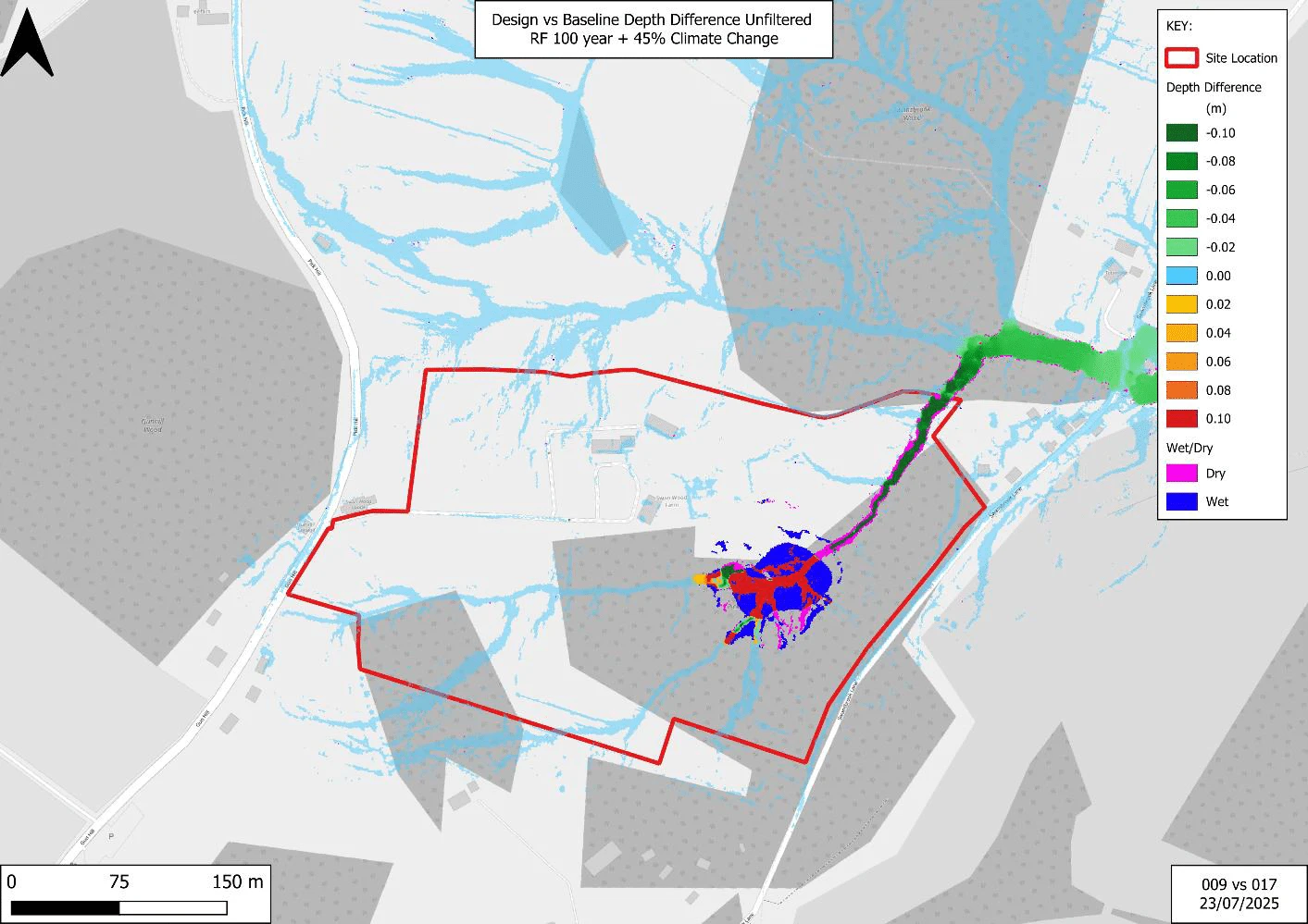
Given the impoundment of a larger volume of water (hence the downstream reduction in flood risk), the LLFA raised concerns that a sudden failure, or ‘breach’ of the embankment could result in sudden downstream inundation, posing a greater risk than the pre-development scenario. As such, Aegaea also conducted breach modelling of the embankment in two scenarios – one whereby the embankment failed during a ‘dry day’ event, where the pond was full of water and the embankment failed with no additional rainfall; and the second a ‘wet day’ event, whereby the pond is full, and a 1 in 100 year +CC (45%) event coincided with the breach of the embankment. The breach modelling demonstrated that downstream risk to buildings was not considerably increased.
The inspector was of the opinion that the works had decreased flood risk downstream due to the impounding of the water and that any increase in risk in a breach scenario would be outweighed by the low likelihood of such an event occurring.