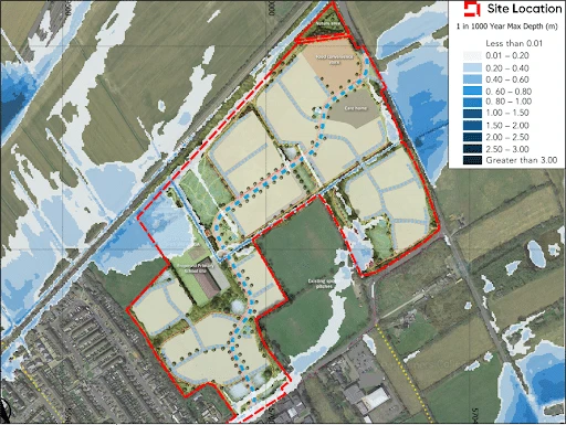
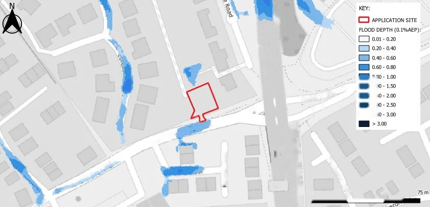
TheEnvironment Agency‘s Risk of Flooding from Surface Water (RoFSW) mapping identified part of the application site as being at risk of surface water flooding. Using high-resolution topographic survey data and site-specific hydraulic modelling, Aegaea demonstrated that the proposed development plot was unaffected by surface water flooding up to and including the 1 in 1000 year event.
The Lead Local Flood Authority subsequently raised no objection to the proposal given the clear compliance with the NPPF and NPPG, allowing the application to progress through the planning process.
The Challenge: Site-Specific Pluvial Modelling Refining the EA Surface Water Mapping
The application site comprised a small infill plot in Woking, Surrey, brought forward for a single residential dwelling with associated parking, landscaping, cycle storage and refuse facilities.
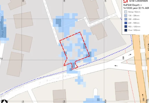
In accordance with Paragraphs 171 and 172 of the NPPF, all sources of flooding should be considered in development planning. While the site sits entirely within fluvial Flood Zone 1, the Environment Agency’s national Risk of Flooding from Surface Water (RoFSW) mapping showed surface water flood risk affecting part of the site and the surrounding road network.
The RoFSW dataset is produced at a national scale and relies on a Digital Terrain Model that may not fully capture local topographic features. On small development sites, subtle changes in levels, kerb alignments and overland flow routes can significantly influence the extent of modelled surface water flooding.
The key challenge was therefore to determine whether the published flood mapping accurately represented flood risk to the proposed development plot itself, rather than the wider surrounding area. This was essential in understanding whether the proposed development was required to be subject to the Sequential Test (noting that the application predates the recent NPPF Paragraph 175 and NPPG Paragraph 027 updates) – which could have been a show stopper for this application based on discussions with the local authority.
Aegaea’s Approach: Site-Specific Flood Modelling
Aegaea developed a site-specific 2D pluvial hydraulic flood model using TUFLOW to assess surface water flood risk across the site and surrounding catchment. The model incorporated the Environment Agency’s 1m LiDAR Digital Terrain Model together with a detailed topographic survey of the site, allowing local ground levels and overland flow routes to be represented more accurately.
Design rainfall was applied directly to the 2D domain using a rainfall-on-grid approach. FEH22 rainfall data was used to derive design rainfall depths and durations, with simulations undertaken for the 1 in 100 year event, the 1 in 100 year plus 45% climate change scenario and the 1 in 1000 year event.
The modelling outputs are broadly aligned with the flow routes identified within the national RoFSW dataset across the wider road network. However, the site-specific modelling demonstrated that surface water flooding remained within the surrounding highway network and did not affect the proposed development plot for any of the modelled events. Where flooding was identified on adjacent roads, flood hazards remained within the Environment Agency’s low hazard classification.
Aegaea prepared a Flood Risk Assessment and supporting technical note setting out the hydraulic modelling methodology, survey information, model assumptions and comparison between the site-specific model outputs and the published RoFSW mapping.
The Outcome
The Flood Risk Assessment and supporting hydraulic modelling, meeting the requirements of the NPPF and NPPG which included the Exception Test and Sequential Test, which were submitted to the local planning authority and Lead Local Flood Authority (LLFA).
Following review of the submitted information, the LLFA raised no objection to the proposed development, allowing the application to progress through the planning process. The flood modelling demonstrated no risk to the site, thus negating the need for a Sequential Test as the modelling showed it was already sequentially located – thus unlocking the site for development. The development could be demonstrated to be safe for its lifetime in accordance with the Exception Test.
This project demonstrates the value of site-specific surface water modelling as a flood map challenge tool. While national flood mapping provides an important starting point for flood risk assessment, higher-resolution topographic data and hydraulic modelling can often provide a more accurate representation of site-specific flood risk. For constrained infill developments, this level of analysis can provide the proportionate technical evidence needed to support planning applications and refine the understanding of surface water flood risk.