The development faced a formal objection from the Lead Local Flood Authority (LLFA) relating to the proposed drainage strategy, discharge rates and supporting technical evidence. Through targeted ground investigation (as required by the 2025 National Standards for SuDS (NSfS)), revised InfoDrainage modelling and direct engagement with the sewerage undertaker, Aegaea developed an NPPF and NSfS compliant surface water drainage strategy that resolved the LLFA objection and supported a recommendation of no objection subject to planning conditions.
The Challenge
The site comprised a previously developed commercial yard and existing warehouse located on a constrained urban-edge plot in Wiltshire. The redevelopment proposals included a convenience / food retail unit, drive-through coffee unit, two B8 trade counter units with ancillary office space, retention of the existing warehouse building, together with associated parking, servicing and access arrangements. Such proposals are considered acceptable in Flood Zone 1 as per Table 2 of the NPPG (Flood risk vulnerability and flood zone ‘incompatibility’), but still requiring a Flood Risk Assessment due to the mapped pluvial risk at the site.
The Lead Local Flood Authority (LLFA) issued a formal objection to the planning application, principally relating to the proposed surface water discharge rate and compliance with the local authority’s Betterment Strategy. The consultation response also identified a range of additional technical information requirements, including confirmation of the proposed sewer connection, CCTV survey data, groundwater risk assessment updates, exceedance flow routing, SuDS cross-sections and long-term maintenance arrangements.
The project also presented significant site-specific drainage constraints. BRE365 infiltration testing identified shallow groundwater approximately 1.2m below ground level, effectively ruling out infiltration SuDS under the 2025 National Standards for SuDS, which require a minimum 1m clearance between the base of any infiltration feature and the seasonal high groundwater table.
This was a key consideration with reference to the SuDS hierarchy as set out in the 2025 National Standards for SuDS. The hierarchy requires runoff from a development to be discharged to the following final destinations, to the maximum extent practicable, in accordance with the below hierarchy:
- priority 1: collected for non-potable use
- priority 2: infiltrated to ground
- priority 3: discharged to an above ground surface water body
- priority 4: discharged to a surface water sewer, or another piped surface water drainage system
- priority 5: discharged to a combined sewer
Water reuse was promoted within the strategy but cannot be solely relied upon meaning another discharge location is also required. The high groundwater ruled out Priority 2, nor were there any above ground water bodies to meet Priority 3. Hence – the strategy then followed the SuDS hierarchy and discharged at Priority 4.
As a result, the drainage strategy needed to balance multiple technical and policy requirements simultaneously – including groundwater protection, restricted cover depths, compliance with the drainage hierarchy, and the local authority’s betterment requirements – while remaining practical and deliverable on a constrained brownfield site.
Aegaea’s Approach - Flood Risk & Drainage Strategy
Aegaea led the flood risk and surface water drainage strategy from concept design through to consultee response and planning support.
Working with the wider client team, Aegaea coordinated additional site investigations including CCTV surveys of the existing drainage network, BRE365 infiltration testing and groundwater monitoring. The CCTV survey data was reviewed internally to verify existing invert levels, pipe conditions and sewer connection arrangements before being incorporated into the updated hydraulic model.
Using the revised site investigation data, Aegaea updated the drainage design and re-ran the hydraulic calculations within InfoDrainage to reflect the constrained site conditions and revised discharge proposals.
In parallel, Aegaea engaged directly with the sewerage undertaker to negotiate a revised discharge consent. We recognise the importance of direct communication with the relevant consultees to ensure the drainage strategy is agreed at the earliest opportunity. Through our proactive engagement, the sewerage undertaker ultimately agreed to a restricted discharge rate of 1 l/s, representing approximately a 75% reduction compared to the existing brownfield runoff rate and bringing the strategy into compliance with the local authority’s Betterment Strategy requirements.
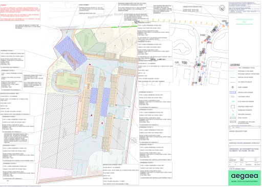
The final sealed SuDS strategy incorporated lined permeable paving, green roofs, proprietary treatment devices, filter drains and below-ground geocellular attenuation tanks with pumped discharge to the receiving sewer network. Updated hydraulic modelling demonstrated that the system could safely accommodate runoff for all events up to and including the 1 in 100 year plus 45% climate change scenario without flooding of the drainage network.
Aegaea coordinated the technical response across the wider design team and prepared the updated Flood Risk Assessment, Surface Water Drainage Strategy, Existing Drainage Report and Flood Evacuation Plan submitted to the planning authority.
The Outcome
Following submission of the revised drainage strategy and supporting technical evidence, the Lead Local Flood Authority formally withdrew its objection and issued a recommendation of no objection subject to standard planning conditions, confirming that the Aegaea drainage strategy was compliant with the NPPF and 2025 National Standards for SUDS.
The agreed conditions covered detailed SuDS design, confirmation of the existing drainage arrangements, exceedance flow routing, construction management and long-term maintenance requirements. The principle of the surface water drainage strategy, discharge rate and downstream sewer capacity were all confirmed as acceptable.
This project demonstrates the importance of combining robust technical evidence with proactive consultee engagement on constrained brownfield developments. Through targeted ground investigation, revised hydraulic modelling and direct coordination with the sewerage undertaker and wider design team, Aegaea developed a policy-compliant drainage strategy capable of resolving complex statutory consultee concerns and supporting the progression of a commercially sensitive planning application.