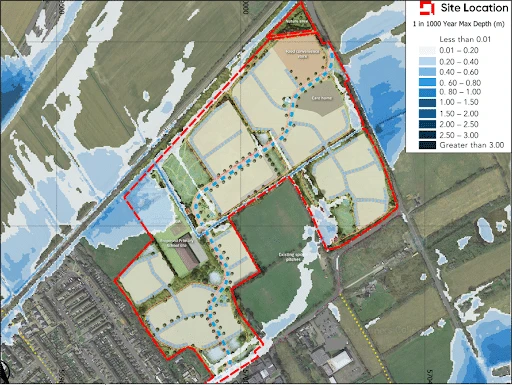
What Are SEPA’s Flood Maps?
SEPA’s flood maps are national datasets used to indicate the likelihood and extent of flooding from different sources. They support early site assessments, planning decisions, and detailed Flood Risk Assessments (FRAs).
They include:
- Fluvial flooding (rivers and watercourses)
- Coastal flooding
- Pluvial / surface water flooding (intense rainfall events)
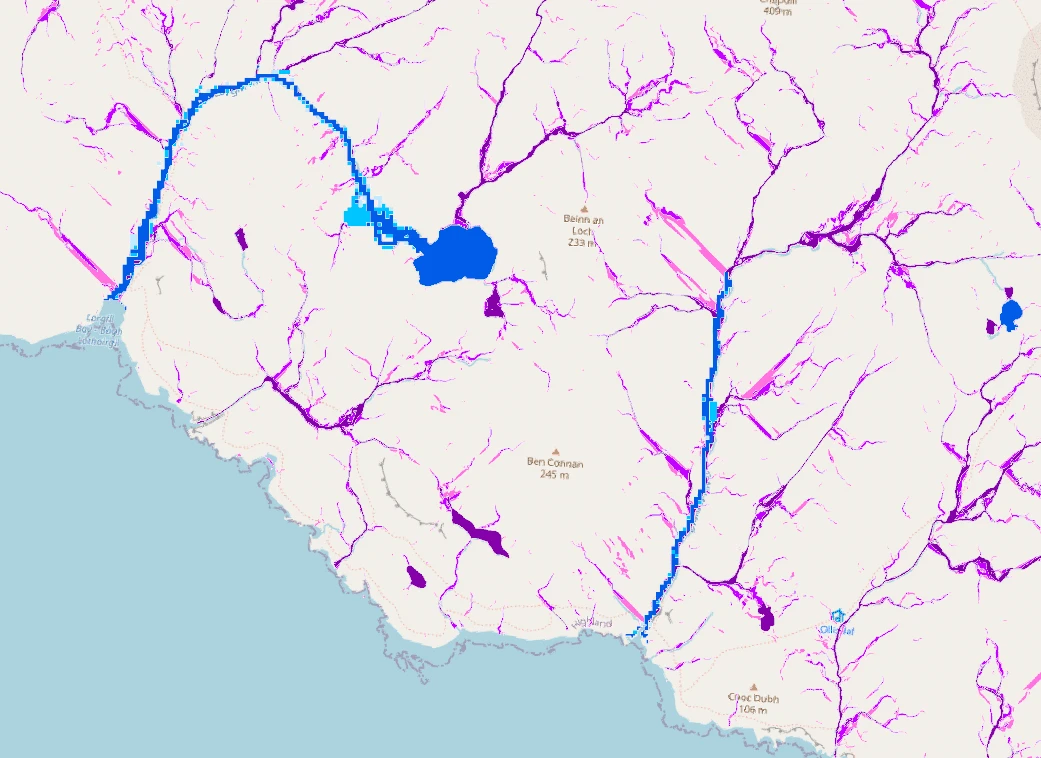
The new “Surface Water and Small Watercourse (SWSW)” Maps merge surface water flooding with fluvial flooding from small watercourses, giving a more complete picture of risk—especially in rural or topographically complex areas.
Why the Differences Matter
The shift from the 2023 Pluvial Maps to the 2025 SWSW Maps is important because:
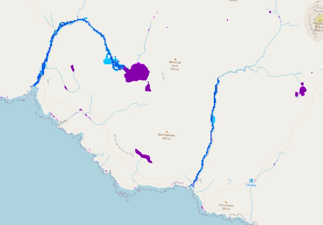
- Smaller watercourses (<3 km²) were previously unmapped in SEPA’s fluvial dataset, meaning some areas looked “safe” when they weren’t.
- Higher-resolution terrain data means better accuracy in identifying potential flood pathways and depths.
- The addition of future climate change extents provides improved early-stage planning insights that align with updated Scottish planning policy (NPF4).
- The combined dataset may help identify where surface water and small watercourse flooding interact, though more interpretation is required to distinguish between flood sources.
What do the SEPA’s SWSW maps represent?
- Fluvial flooding on a national level for catchments less than 3km² – areas below 3km² are not covered by
- fluvial mapping dataset, so this is an improvement to the indicative representation of the flood risk from smaller watercourses.
- For catchments between 3km² and 10km², the risk of fluvial flooding is generally better represented by
- SEPA’s SWSW Flood Maps than in comparison to SEPA’s Fluvial Flood Maps.
- Benefits rural areas in Scotland, where fluvial flood risk information is limited due to small catchment areas and the lack of freely available elevation data.
SEPA’s Pluvial Flood Maps (2023) vs SEPA’s SWSW Flood Maps (2025)
- The updated SWSW Flood Maps now include Future Medium Flood Extents, which take climate change into consideration — a dataset not previously modelled in SEPA’s 2023 Pluvial Flood Maps.
- Updated climate change allowances, reflecting the most up-to-date information for planning. However, the allowances applied are based on universal storm durations for all catchments, meaning they remain indicative rather than site specific.
- 2m grid cell resolution, compared to the previous 5m cell resolution — significantly improving spatial detail.
- The maps now include both surface water and fluvial flooding extents (from small watercourses), meaning additional interpretation is required to understand the source of the flooding.
- Although the dataset has been modelled with over 51,000 structures, any structures not meeting modelling criteria are excluded. These still need to be assessed in detail within a site-specific FRA where relevant.
- Filtering Note: SEPA’s Surface Water and Small Watercourse (SWSW) Flood maps have been filtered to exclude very small flooding areas (less than 48 m²) and are also filtered by hazard rating, which considers both depth and velocity. While the same filtering approach can be applied in site-specific surface water modelling, fluvial modelling for small watercourses typically does not use these filters.
Flood Protection Schemes Explicitly Modelled
- Stonehaven Flood Protection Scheme (Aberdeenshire Council)
- Smithton and Culloden Flood Alleviation Scheme (Highland Council)
- Knowle Burn Flood Protection Scheme, Dumbarton (West Dunbartonshire Council)
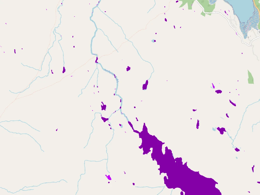
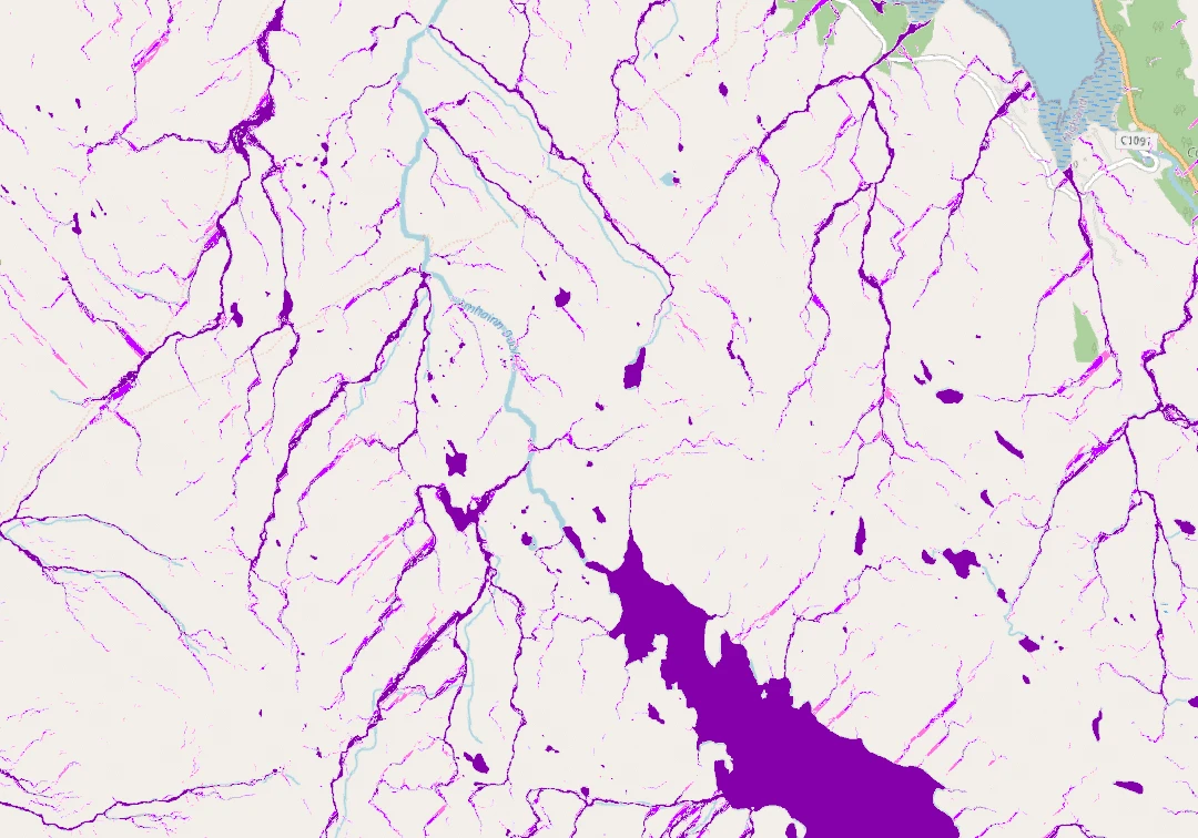
Differences in the mapping 2023 vs 2025
To visualise the significance of the changes below is an example in the Scottish Highlands showing the mapping from 2023 vs 2025.
Talk to flood risk experts in Scotland
The 2025 SWSW Flood Maps provide more accurate, detailed, and climate-aware flood risk information than previous datasets. For planners, developers, and flood risk consultants, understanding these updates is essential for informed decision-making, early-stage planning, and ensuring compliance with Scottish planning policies.