Overview
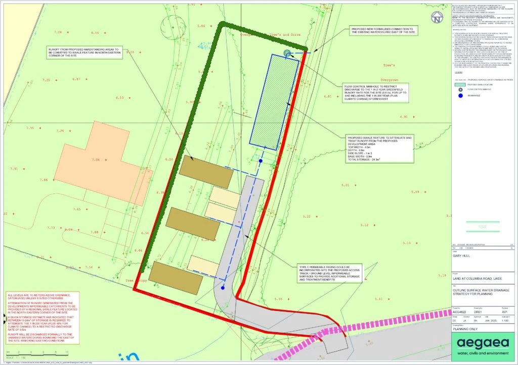
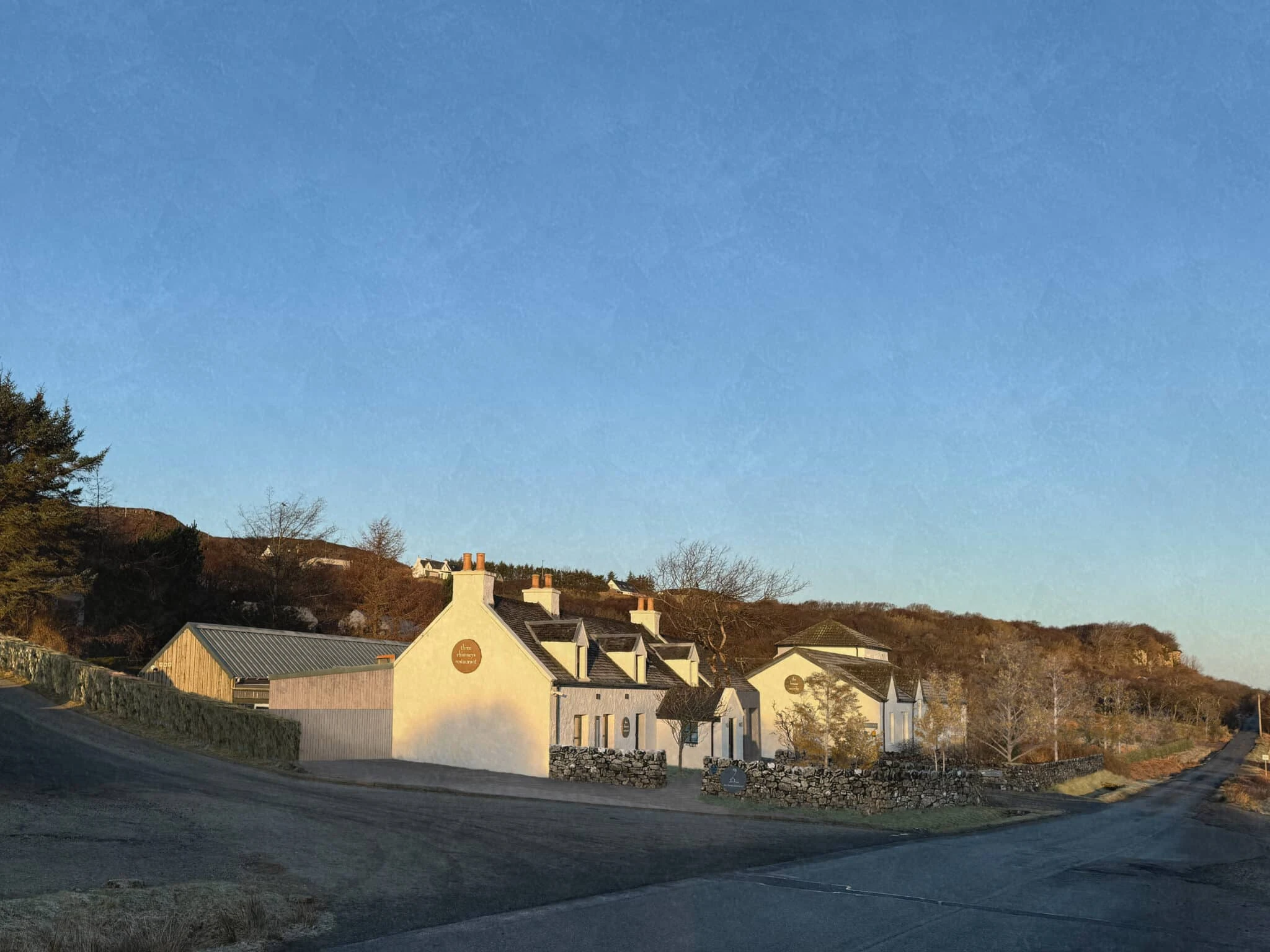
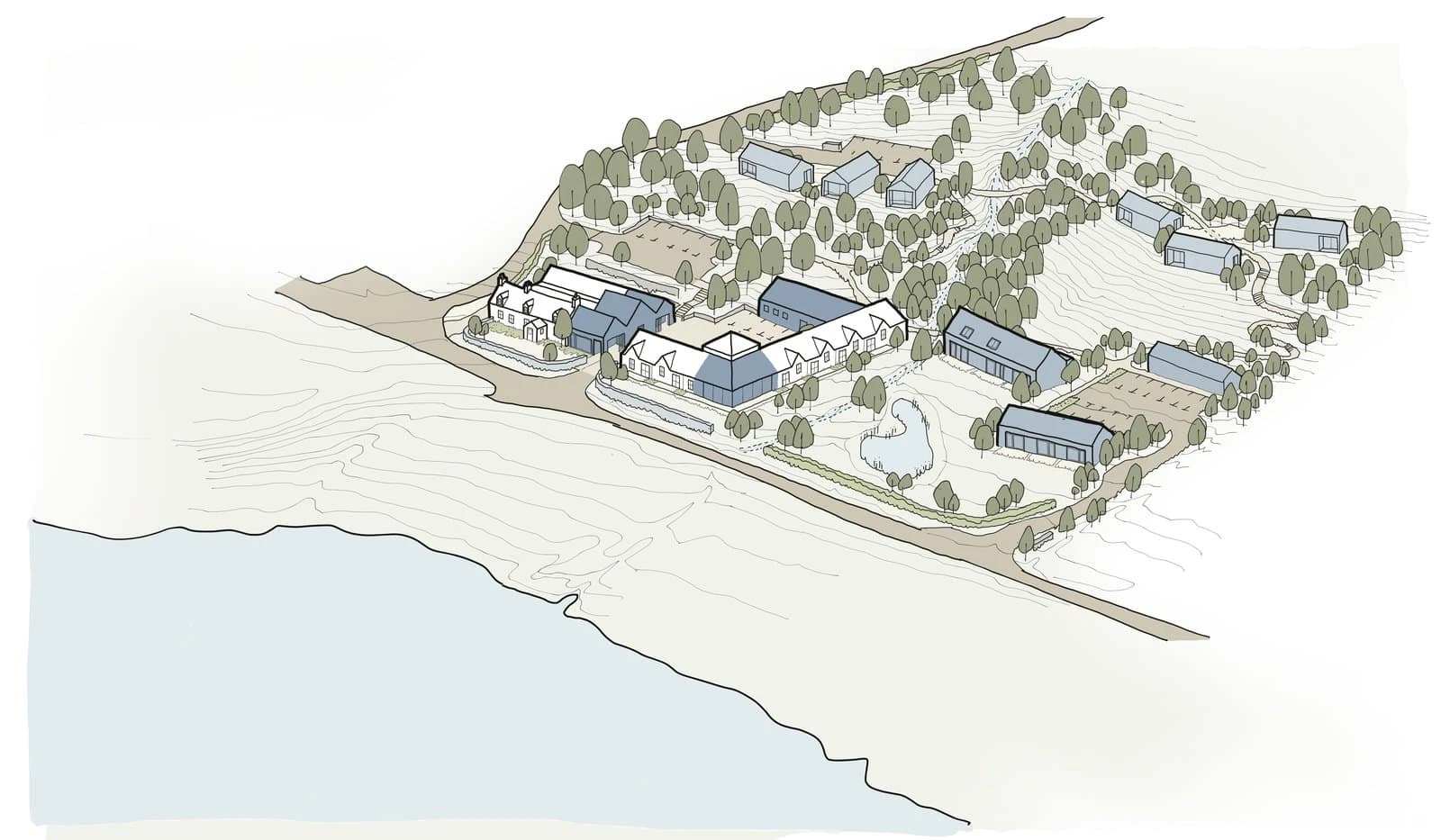
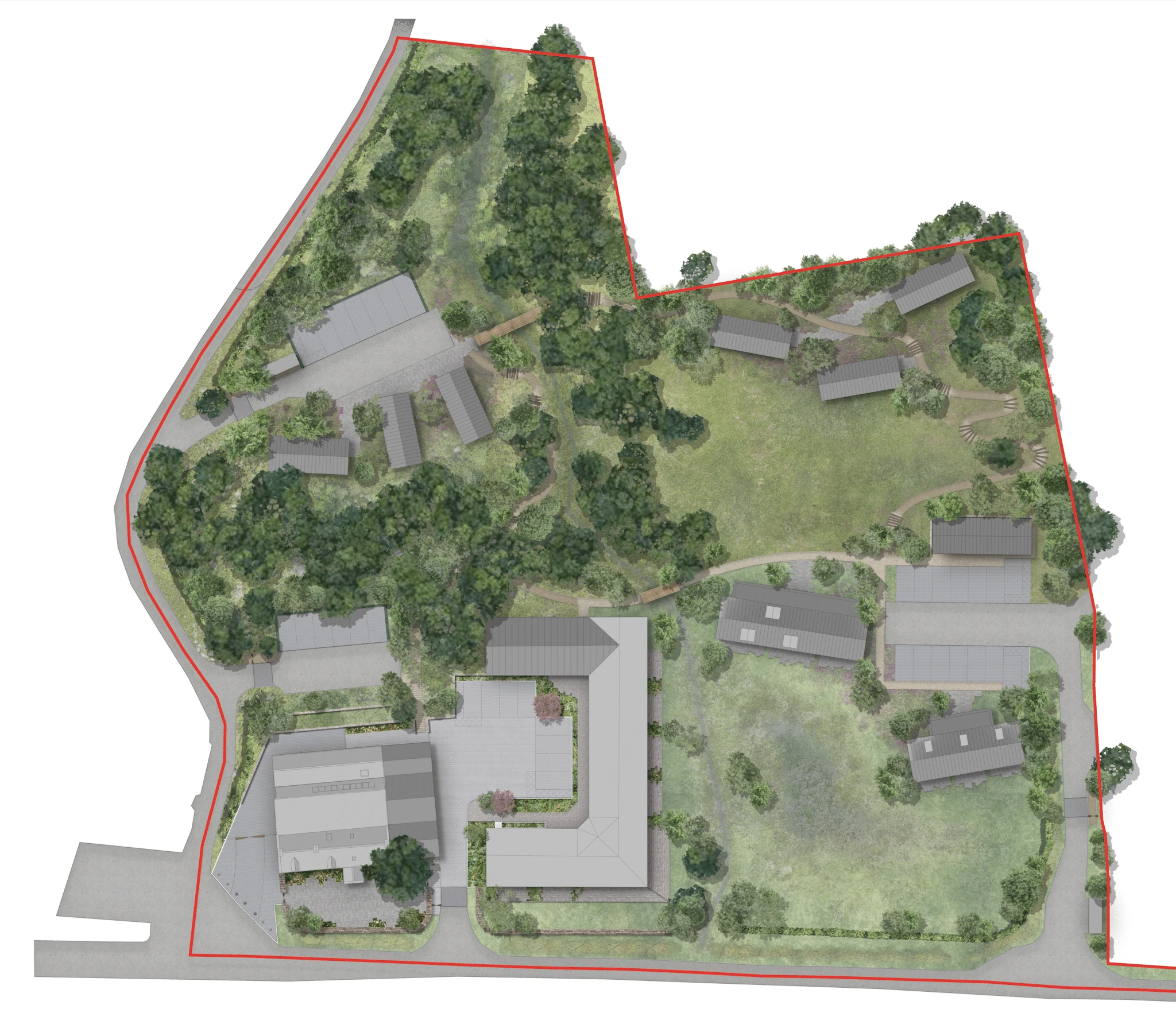
The Three Chimneys is one of Scotland’s best-known restaurants, with rooms sitting on the shore of Loch Dunvegan at Colbost on the Isle of Skye. The Wee Hotel Company, proposed a substantial refurbishment and expansion: modernisation of the existing restaurant and accommodation, new self-contained holiday units, additional hotel accommodation, relocated services, additional parking, and two new crossings over a watercourse that flows through the middle of the site.
Two small burns cross the site. Neither is mapped in SEPA’s fluvial flood risk mapping dataset, because both catchments are too small to appear in SEPA’s national river modelling.
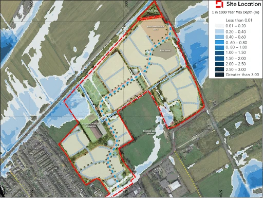
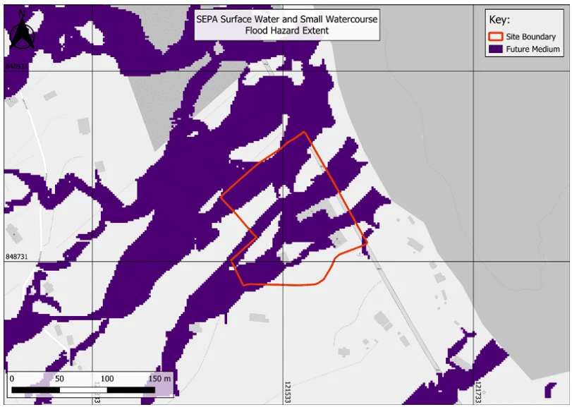
Aegaea was commissioned by The Wee Hotel Company to produce a Flood Risk Assessment to accompany a planning application, just prior to SEPA publishing its updated surface water and small watercourse flood maps at the start of 2025. Following a swift review of the updated dataset – the site’s initial screening position changed with the site falling partially within the high, medium, low and future medium surface water and small watercourse hazard extents.
This required immediate expertise and consultation to understand how these new extents impacted both the site and the level of assessment required to comply fully with both The Highland Council (THC) and SEPA criteria.
The project evolved from a desk-based Level 1 assessment into a full Level 3 Flood Risk Assessment. This included creating a new linked 1D-2D hydraulic model of both watercourses, constructed using a site-specific drone and channel topographical survey, and tested against blockage, roughness, flow and tidal sensitivity to satisfy SEPA’s requirements.
The Challenge
The proposal is classed as Highly Vulnerable under SEPA’s Flood Risk and Land Use Vulnerability Guidance, and increasing the number of overnight accommodation units increased the land use vulnerability of the site. That classification brings the full weight of Policy 22 of National Planning Framework 4 and Policy 64 of the Highland-wide Local Development Plan into force. Under NPF4, a Highly Vulnerable use that is not one of the listed exceptions must avoid the flood risk area. Compensatory storage, elevated development or any other form of mitigation is not permitted under these conditions.
SEPA’s Fluvial Flood Maps show the site as entirely outside any modelled river flood extent; the nearest extent is 1.8km away on the Brunigill Burn. Watercourses with catchments below 3km² are not included in SEPA’s fluvial mapping at all.
Aegaea was initially appointed in 2024 on the basis of the mapping that existed at the time of commission which showed no fluvial flood risk. Early in 2025, with the first issue of the Level 1 FRA assessment already delivered, SEPA published its updated flood maps – including the current Surface Water and Small Watercourse Flood Hazard layers.
The Level 1 FRA was swiftly updated and enhanced to a Level 3 Flood Risk Assessment supported by site-specific hydraulic modelling. SEPA’s mapping is strategic in nature and for site specific assessment, hydraulic modelling is a requirement to determine developable areas, assess the impacts with regards to access / egress, and to inform any new structure design.
Aegaea’s Approach
Initially, producing a site specific hydraulic model for the site posed several challenges that had to be overcome:
- No usable public terrain data. There is no suitable public LiDAR coverage for the site. Aegaea supports the client in obtaining a site-specific topographical, channel and drone survey in July 2025 producing a 1m resolution digital terrain model.
- Catchments too small for the FEH Web Service. At 0.46km² and 0.11km², neither catchment is represented on the FEH Web Service. Catchment descriptors had to be transferred from a donor catchment in line with SEPA’s hydrological guidance. Design flows were estimated for both catchments using two independent methods for cross-comparison
Both methods yielded similar peak flow estimates for the 1 in 200 year flow rate, which gave confidence in the assessment.
As both catchments are smaller than 30 km², SEPA’s guidance requires a peak rainfall intensity uplift rather than a peak river flow uplift; the site sits in the West Highland River Basin Region, giving a 48% uplift.
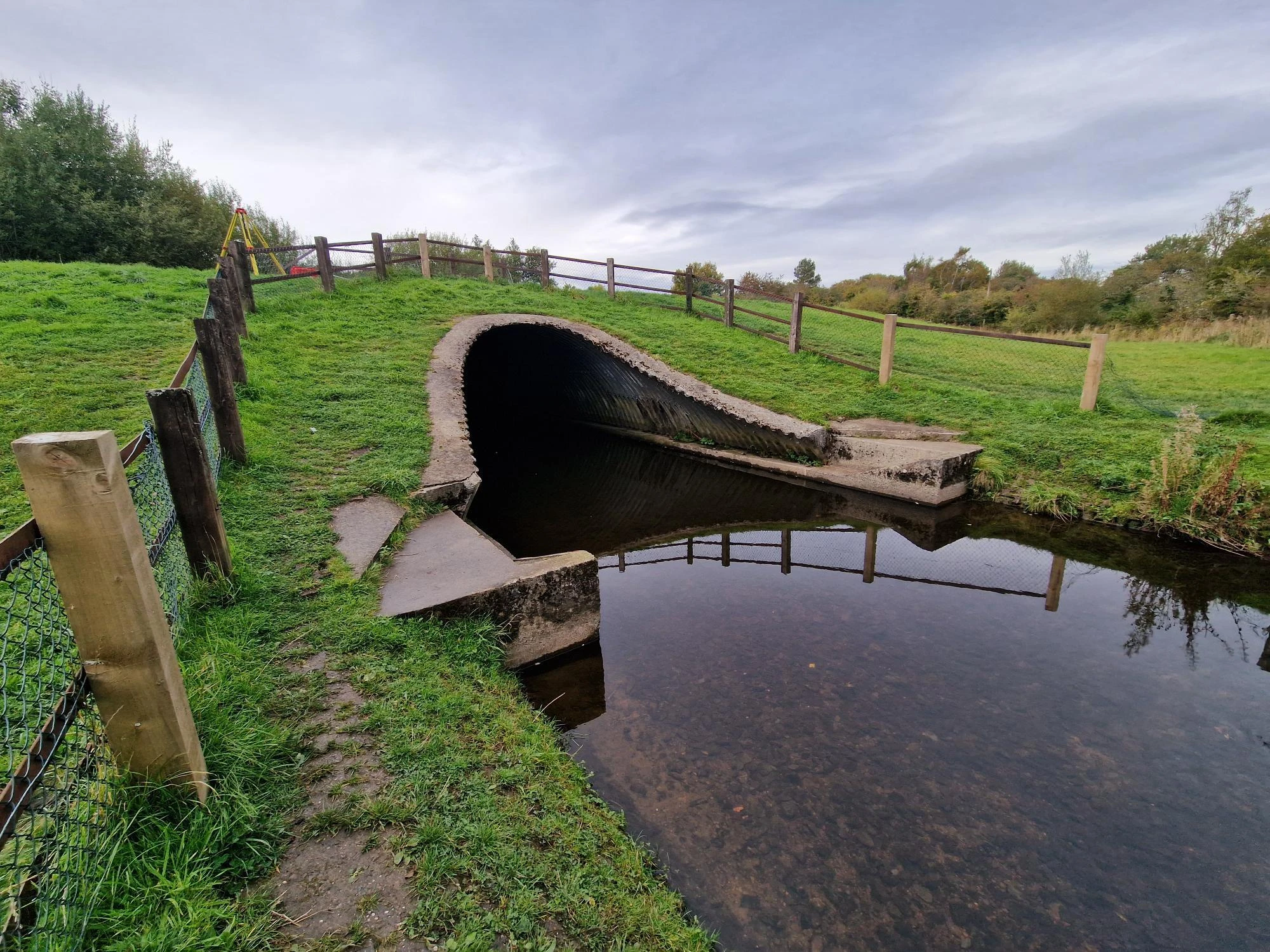
- Existing structures with blockage potential. Both burns pass through as they leave the site, and SEPA requires structural blockage to be considered when defining a flood risk area (for both existing and new structures). This is a lesser known requirement when estimating the flood risk area for any site in Scotland, however, due to Aegaea’s vast experience across the country we were able to include this simulation within the original scope of works. A dynamically linked 1D–2D model was built in ESTRY-TUFLOW The 1D domain represents both open channels and the culverts from the surveyed cross sections; with the 2D domain adopting a 1 m grid size matched to the resolution of the site-specific topographical and drone survey.
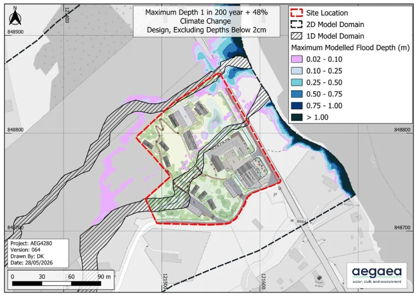
Following the hydraulic modelling exercise the modelled 1 in 200 year plus 48% climate change event (plus blockage) indicated that very shallow depths of water would flow across a large proportion of the site.
Aegaea met with The Highland Council’s Flood Risk Management Team on 14 August 2025, and through detailed and pragmatic discussion – a reporting threshold of 0.01m was agreed as appropriate given catchments below 0.5 km², and confirmed in the Council’s consultation response of 22 October 2025. This was later refined further, following discussions with both the Highland Council and SEPA, outputs were presented filtered at 0.02m. SEPA itself accepted that depths of less than a centimeter were not significant enough to prevent development for this particular site. This statement also was applied to the proposed safe access / egress route from the site.
However, as shallow water is present across the site during the design storm event, the Council’s condition of a 300mm freeboard between finished ground level and finished floor level in any area of possible residual risk was adopted across the scheme, and the proposed buildings were modelled with raised finished floor levels so that the predicted depths have no effect on them.
From that basis the assessment went on to shape three separate aspects of the scheme:
Site layout. Modelled extents were used to assess each plot rather than the site as a whole, with Aegaea assisting in the final approved site layout ensuring compliance with NPF4 Policy 22.
Finished floor levels. Aegaea derived the maximum ground level within each proposed building footprint from the site-specific DTM and hydraulic model outputs. This informed suitable finished floor levels with the 300mm freeboard applied above.
Structures design. The two proposed crossings were designed against modelled water levels using the hydraulic model. In accordance with SEPA criteria – soffits were set a minimum of 600mm above the peak 1 in 200 years plus climate change level.
The Outcome
Following amendments to the site layout – the Addendum Revision A and the revised drawings were submitted in June 2026 and consulted on four days later.
SEPA withdrew its objection on 17 June 2026 (ref. PCS-20009054), confirming that the revised layout located all new buildings outside the flood risk area, that both footbridges had been modelled at 50% and 75% blockage without increasing flood risk to any existing or proposed building, and that the 300mm freeboard between finished ground and finished floor level had been confirmed.
The Highland Council’s Flood Risk Management Team confirmed no objection on 24 June 2026, withdrawing its earlier request for a flood risk addendum condition and accepting the access road’s encroachment into the northern watercourse’s 6 m riparian buffer on the basis of unchanged ground levels and boulder edge protection.
Full planning permission was granted on 14 August 2026 (ref. 25/00677/FUL), covering the restaurant extension, hotel alterations, eight self-contained holiday units, a storage shed, landscaping, EV charging infrastructure, cycle and car parking, servicing, sewage treatment plants and access. The flood risk conditions carried into the consent reduced to two: the 300 mm freeboard, and protection of the riparian buffer.
Every proposed building sits outside the 1 in 200 year plus 48% climate change flood risk area, defined with blockage applied. Finished floor levels carry a 300mm freeboard above ground level, safe access and egress is demonstrated on a route that stays dry throughout the design event, and both crossings clear the design flood level by 600mm without increasing risk to the existing restaurant when blocked.
Our Expertise: Small Watercourses, High Evidential Bars
The Three Chimneys site is a good example of the niche in which Aegaea has built real depth of experience: rural, remote and island sites across Scotland where the watercourses are too small to be mapped, reliable terrain data is absent, the national mapping can be reissued during a live commission, and the consenting decision relies entirely on evidence that does not yet exist.
On this project Aegaea provided:
- Reassessment of the site against SEPA’s updated 2025 flood mapping mid-commission, and escalation of the assessment from Level 1 to Level 3 in response
- Specification and use of a topographical, channel and drone survey campaign to build an appropriate Digital Terrain Model suitable for hydraulic modelling
- Hydrological analysis of two sub-0.5km² ungauged catchments using donor catchment transfer, with ReFH2 and FEH Rainfall-Runoff comparison and justified method selection
- A dynamically linked 1D–2D ESTRY-TUFLOW HPC model of two watercourses, their structures and the floodplain, at 1m resolution
- Blockage assessment from 50% to 100% on every existing and proposed structure
- Sensitivity testing across roughness, inflow and downstream tidal boundary
- Assessment of flood risk from all sources
- An agreed method for reporting shallow flood depths, with filtered and unfiltered outputs published side by side through collaboration with regulators
- Determination of the flood risk area, finished floor levels and freeboard, with modelled levels used to inform the site layout plot by plot
- Resolution of a safe access and egress constraint through dry-route identification and depth-based hazard characterisation, agreed with the Council
- Hydraulic design input to bridge crossing position, form and soffit levels
- Sustained, evidence-led engagement with SEPA and The Highland Council FRM Team through multiple rounds of consultation.