Key takeaways
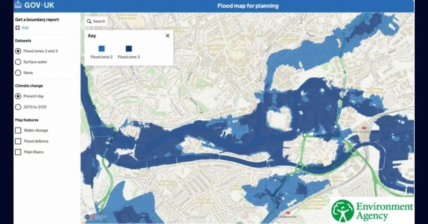
- New NaFRA2 flood zone data will be released by the Environment Agency and used by planning authorities when assessing flood risk.
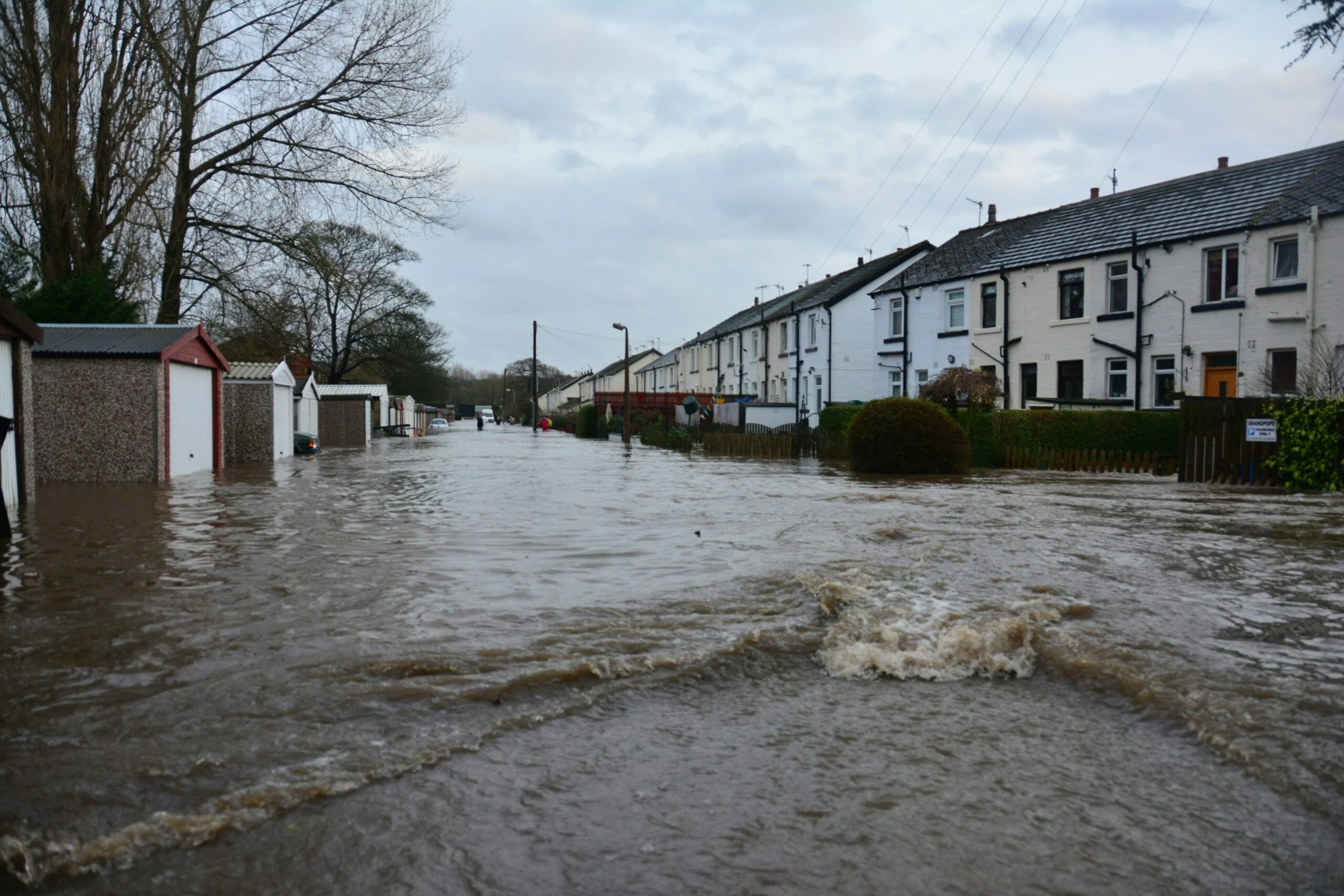
- More properties are expected to be considered ‘at risk’ as a result and require flood risk assessments.
- The new datasets include Climate Change Projections (UKCP18) for the first time, though these may be limited in detail.
- New information will display surface water risk and show how climate change may affect future flood extents, facilitating more comprehensive flood risk assessments.
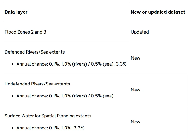
- Defended Rivers/Seas, 3.3% to be displayed (Flood Zone 3b).
What are the changes?
Following the NaFRA2 updates in January, the Environment Agency’s March 25th update integrates new datasets to Flood Maps for Planning. This includes new and updated versions of ‘Flood zones’, climate change projections and improved technology.
Key features of the updated datasets
- Enhanced Local Data Integration : The new datasets combine detailed local flood risk models with national data, offering a comprehensive view of flood risk across England.
- Climate Change Projections : Incorporating UK Climate Projections (UKCP18), indicating the possible impacts of climate change on future flood risk
- Improved Accuracy and Resolution : High-resolution maps and refined modelling techniques provide more precise flood depth and extent predictions, allowing for better risk assessment and decision-making.
What are the implications?
We explore the implications of the new NaFRA2 data in more detail on our blog (linked here). In summary, more areas are now classified as at risk. As a result, some locations previously outside flood zones may now require further assessment, including Flood Risk Assessments (FRAs).
This update will impact both new and existing planning applications. Applications submitted before 25 March 2025 may be rescreened by local authorities where additional information is required. If a site’s flood zone classification has changed, further reports may be required to meet local authority requirements.
- Increased Properties at Risk : The updated datasets indicate that approximately 6.3 million properties are at risk of flooding from rivers, the sea, or surface water, a notable increase from previous assessments.
- Surface Water Flooding Risks : Around 4.6 million properties are now identified as being at risk from surface water flooding—43% more than in prior assessments due to improved modeling.
- River and Sea Flooding : An estimated 2.4 million properties face flood risks from rivers and the sea, with an 88% rise in properties classified as highest risk.
- Future Projections : Given current climate trends, one in four properties in England could be in flood-prone areas by the mid-century.
Future Updates from The Environment Agency
The Environment Agency plans to enhance its flood risk information by integrating updated local data and advanced modelling starting in summer of 2025. As of March 2025, the agency aims to refresh flood risk data every three months and coastal erosion data annually. However, they note that this schedule may evolve in 2025/26 as their approach is refined.
The importance of good data
One of the reasons for the increase in properties now classified as at risk is the advancement of data capture methods, improved modelling and technology. As a result, locations that may have previously been overlooked are now recognised as being at risk, providing a more realistic and data-driven understanding of flood hazards.
Accurate, high-quality data is the foundation of effective flood risk management. Without reliable data, decisions about planning, development, insurance, and emergency preparedness can be flawed, leading to unnecessary risks or costly mistakes.
In January 2024 Aegaea collaborated with Storm Geomatics on a webinar exploring the importance of good data in flood risk.
“By producing hydraulic models informed by good data capture this leads to a greater representation, greater accuracy and with that better data capture we’re much more able to identify those areas which are at higher risk of flooding. We can then better advise on the type of mitigation including defences that could be needed. This increase in accuracy allows for more informed decisions and should lead to better overall design.”
– Daniel Cook, Director of Aegaea and Chartered Water and Environment Manager and specialist Flood Risk Consultant
How we can help
While the new datasets mark a significant improvement in flood risk assessment, they come with both limitations and potential obstacles, which is why flood risk consultants remain essential for accurate, site-specific evaluations.
Aegaea’s expert Flood Risk Consultants offer a free unique quote bespoke to your requirements – no obligation and no risk. Contact us here or call us on [020 8156 6076](tel: 020 8156 6076).