Flood Risk and Surface Water Drainage in Enfield
Flood Risk Assessments (FRA) in Enfield
The latest NAFRA2 report states “Over one quarter of properties in areas at high flood risk from surface water flooding are in London – nearly a third of a million”
The London Borough of Enfield has several bespoke planning policies and numerous Critical Drainage Areas (CDAs) to navigate. Enfield can seem at first glance a problematic region to gain planning approval for your project. However, have no fear! Over the last 3 years, Aegaea has been involved with over 100 different projects minor through to major applications within the area, covering both flood risk and drainage.
In line with the Enfield Council’s Validation Checklist (updated in October 2024), you’ll need to provide a Flood Risk Assessment if the development involves any of the following constraints (this includes Minor Developments);
- Surface water flood risk (Or in a CDA)
- Flood Zone 2, 3a, 3b.
- Greater than 1ha
- Proposals including new buildings, basements, extensions to basements, extensions within 8m of a watercourse
What Should My Flood Risk Assessment in Enfield Include?
A Flood Risk Assessment must include an assessment of the risk of flooding from all sources and an assessment of the potential for the development to increase risk elsewhere.
However, the specific advice listed in Enfield’s Validation Checklist includes the following;
- Finished Floor Levels to be set at least 150mm above the 1:100 Year Surface Water Flood Level (plus climate change);
- Finished Floor Levels to be set at least 300mm above the 1:100 Year Fluvial Flood Level (plus climate change);
- Level for Level Floodplain Compensation – if the development is located within either of the 1:100 Year Flood Level (plus climate change) for fluvial or surface water flooding. This is an important requirement as not all councils require Floodplain Compensation;
- A Flood Management/Evacuation Plan must be provided demonstrating that the evacuation route is in the “Very Low Hazard Level”;
- Flood resistant and resilient measures should be utilised where appropriate.
Floodplain Compensation is when a section of the site (i.e. a small section of the garden) is lowered during construction to prevent any flood water displaced by the development increasing risk elsewhere.
Due to our vast experience working within the region, Aegaea are best placed to assist you with any form of development, and this experience has allowed us to stay firmly on top of the bespoke flood risk policies specific to Enfield.
This includes ensuring that we have access to the best available flood risk data specific to Enfield. A little known example of which is found within Paragraph 3.27 of the Enfield SFRA, which states that:
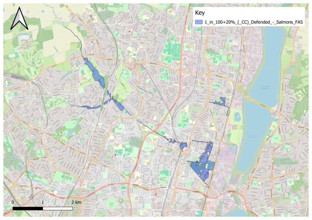
“The Environment Agency’s Risk of Flooding from Surface Water (RoFSW) flood map provides an indication of the scale and distribution of surface water flood risk. The mapping was produced at a national scale and consequently does not always represent local flood risk accurately. To enhance this mapping, Enfield have developed direct rainfall modelling (as mentioned previously in paragraph 3.3). In 2012 Enfield’s Surface Water Management Plan (SWMP) 25 and a series of subsequent surface water studies identified Critical Drainage Areas across the borough, where surface water flood risk is considered to be most significant. The direct rainfall modelling has been calibrated by reviewing these studies and comparing the outputs with a number of historical extreme rainfall and flood events. Currently this exercise has only been carried out for the Pymmes Brook and Salmons Brook catchments. As the direct rainfall modelling is considered to be superior to the national RoFSW mapping it is proposed to use the outputs from the direct rainfall modelling for Enfield’s surface water flood map in the Pymmes Brook and Salmons Brook catchments. In other areas of the borough, the Turkey Brook and River Lee catchments, the RoFSW maps will be used for surface water flood risk”.
This means that although the EA’s RoFSW dataset is generally applicable to assess the risk of flooding to developments across England – Enfield make it clear that there is superior data available for the Pymmes Brook and Salmons Brook catchments.
The good news is that Aegaea hold this modelled flood data on file, saving time and being able to make sure that your Flood Risk Assessment uses Enfield’s preferred dataset.
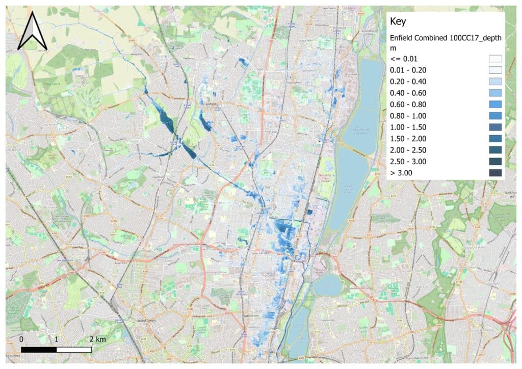
Salmons Brook 1 in 100 Year + 20% Climate Change (Defended) Extents
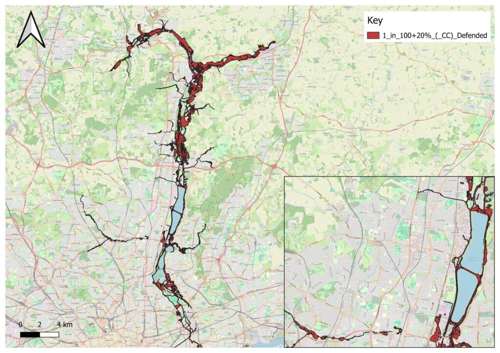
River Lee 1 in 100 Year + 20% Climate Change (Defenced) Extents
Enfield Combined Fluvial / Pluvial Model 1 in 100 Year + 17% Climate Change Extents
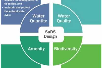
Sustainable Drainage Systems (SuDS)
Most if not all developments in Enfield are now required to demonstrate how surface water will be managed as part of the development.
To make sure that your development complies with Policy CP28 of the Enfield Core Strategy (2010), the relevant policies of the London Plan (SI12 and SI13), as well as the NPPF, must be demonstrated through relevant calculations and assessments that the disposal of surface water is by the means of a suitably designed sustainable drainage system (SUDS) – for all developments.

This means adhering to the London Plan Drainage Hierarchy – aiming to achieve greenfield (i.e. pre-development) runoff rates whilst assessing the following disposal solutions in order (note our previously published blog on the London Plan Drainage Hierarchy provides further information on the below):
1 store rainwater for later use
2 use infiltration techniques, such as porous surfaces in non-clay areas
3 attenuate rainwater in ponds or open water features for gradual release
4 attenuate rainwater by storing in tanks or sealed water features for gradual release
5 discharge rainwater direct to a watercourse
6 discharge rainwater to a surface water sewer/drain
7 discharge rainwater to the combined sewer.
Therefore as a minimum, the following information will likely be required to supplement the surface water drainage strategy:
- Infiltration testing (in accordance with BRE 365 digest). To provide the key evidence Enfield Council need to understand if there is potential for an infiltration-led solution. We work with contractors who can undertake this and are happy to source a quotation for the testing if desired during the project
- Thames Water asset plans will need to be acquired in order to understand if there are any public sewerage assets within the vicinity, which could be utilised for discharge as a fall back option provided infiltration is not viable for your site. This will in most cases need to be supplemented by a CCTV survey to understand both the existing drainage network on-site, and existing invert levels to inform the proposed sustainable drainage design. Again, Aegaea are more than happy to source a suitable contractor to undertake this.
- If a discharge to a public sewer is deemed the best disposal option in line with the hierarchy, a formal capacity check is usually required in order to confirm if Thames have space within their assets to support the development. Aegaea can undertake this when required to save you time!
Previously, In line with the Enfield Council’s Validation Checklist you’ll need to provide a Surface Water Drainage Strategy if the development involves any of the following;
- Major developments
- Commercial/community/industrial changes of use or new buildings or extensions to basements or ground level extensions
- New residential buildings or extensions to basements or ground level extensions (this is an important requirement, as not all Councils request Surface Water Drainage Strategies (SuDS) for extensions.
Every submitted Surface Water Drainage Strategy for the developments listed above must have included a SuDS Proforma checklist to accompany the submission as standard.
For the case of minor developments, there is some discrepancy in what the council requires in terms of a planning application. Previously, the level of detail required was similar to that outlined for the above applications, However, recent updates and correspondence with the Council at the end of 2024 have now indicated that minor developments (i.e. developments below 250m2 and all Householder developments) may only require their specific SuDS proforma to be completed, which should include:
- Drainage (and other) Drawings showing the location of the proposed SuDS features
- Specifications and cross sections of the proposed SuDS features
- Management Plan for future maintenance of the proposed SuDS features
This means that although Enfield Council do require information on the proposed SuDS features for minor developments, it may not be as extensive as previously required, potentially saving on both time (and cost) in getting your development over the line! Future conditions could be imposed to provide further detail.
How Can Aegaea Help?
Due to Aegaea’s experience working on Flood Risk and Drainage in Enfield Aegaea hold the Environment Agency’s modelled flood data on file and can advise you on the risk of surface water or fluvial flooding to your development.
As such, we can advise you on the requirements for Finished Floor Levels, Floodplain Compensation, Flood Evacuation Plans and Resistance/ resilience measures.
Additionally, due to our experience working in Enfield we understand the expectations from Enfield Council with regards to SuDS, for all forms of development. We can provide a bespoke and complaint SuDS design in line with Enfield’s requirements, as well as source the required information (infiltration testing, CCTV surveys and public asset plans) so you don’t have to.
Not only that, our in house Civil Engineering team can take your drainage design (both surface and foul) right though to detailed stage (for construction), and we’ll keep you updated every step of the way. Get in touch to find out more.
About the Author
Request your free, expert quote now
Aegaea work alongside home owners, private developers, planning consultants, architects, local authorities, international development agencies and contractors. Aegaea know exactly how to help you.


