SEPA Launches New Surface Water & Small Watercourse Flood Maps
On the 12th of March 2025 a significant update to the Scottish Environment Protection Agency (SEPA)’s mapping was introduced in the form of the publication of a new surface water and small watercourses flood mapping dataset to accompany the existing fluvial (rivers) and coastal mapping extents.
Key Takeaways
- New SEPA mapping was released on 12 March 2025
- Coverage now includes smaller catchments (<3.0 km²)
- Map resolution has improved
- A future medium flood risk layer is included, accounting for climate change
Coverage of Smaller Catchments
Previously, the limitations of SEPA’s mapping were that flood extents from small watercourses with catchment areas/watersheds smaller than 3.0km2 were not displayed, which at first glance could be misconstrued as an indication that your site was not at risk of flooding and outside of the flood risk area. This is good news for developers as it gives an early indication where flooding may occur and assist with site planning; however digging a little deeper, there are some interesting elements to this new dataset, especially in rural areas of Scotland.
Methodology and Digital Terrain Data.
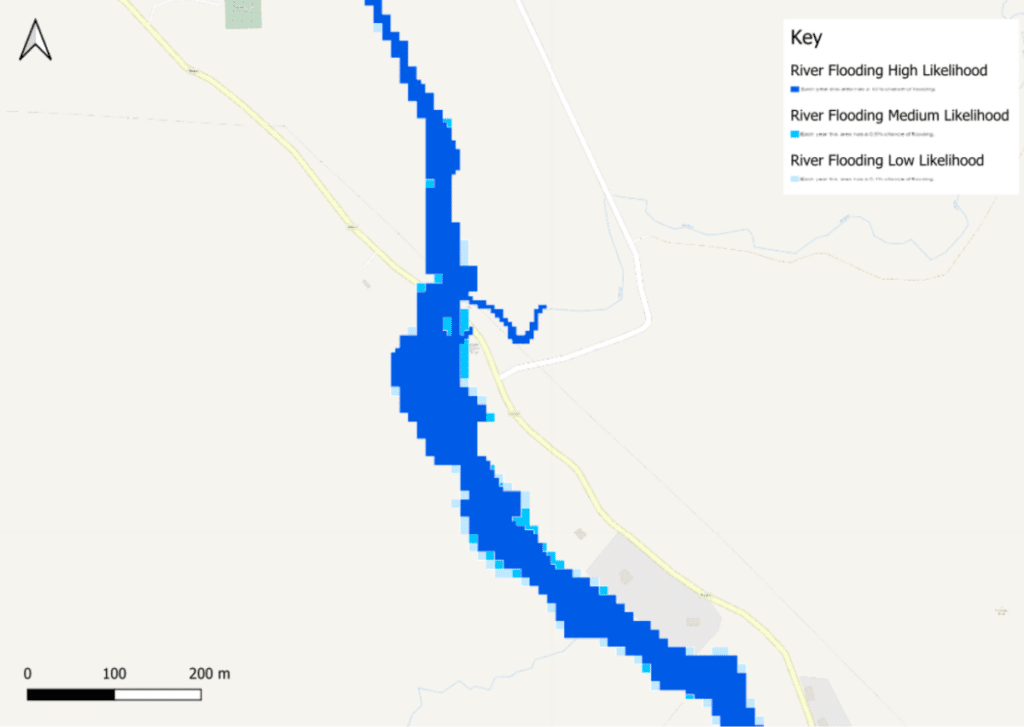
SEPA’s current fluvial dataset utilised Digital Terrain Data with varying grid resolution, which, in rural areas in north-western Scotland, can be up to 20m (Figure 1). This generally results in pixellated fluvial extents with a lower degree of confidence for all modelled likelihood events (high, medium, low, and future risk).
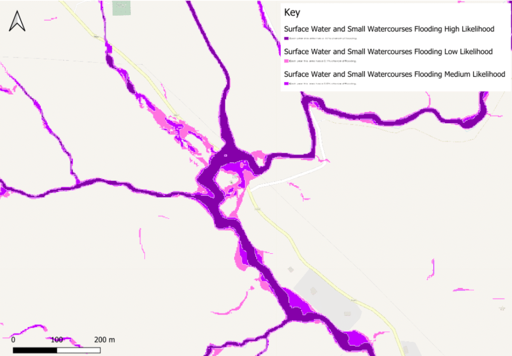
The new small watercourse and pluvial dataset incorporates a resampled 2.0m spatial resolution DTM, developed using the already available Light Detection and Ranging (LiDAR) and photogrammetry data from 25 data sources (figure 2). This increased resolution results in greater confidence when analysing the surface water and small watercourses flood maps and could mean that watercourses with catchments between 3- 10km2 are likely better represented in this new dataset and not the existing fluvial (river) mapping. SEPA do make it clear that users consult both the river and surface water flood maps to understand flood risk from small watercourses.

Figure 1
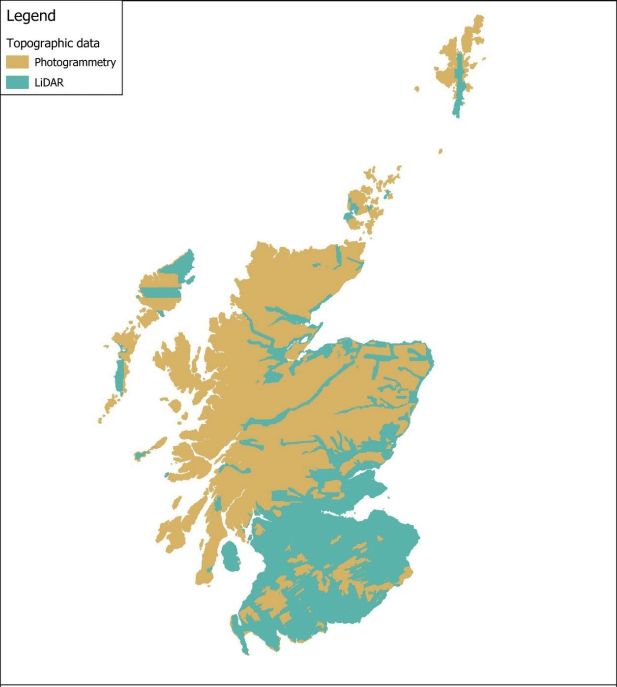
Figure 2
Rainfall and Climate Change
New dataset incorporating climate change allowances
The new dataset incorporates a future medium surface water and small watercourse layer, which incorporates an allowance for climate change. Please note that although the climate change allowances for smaller watercourses are more in line with the values from the February 2025 issue, there are still some discrepancies, with the new future pluvial and surface water extents having smaller allowances for climate change than the ones presented within SEPA’s Climate Change Allowances for Flood Risk Assessment documentation. Further information on updated climate change allowances can be found in our recent blog discussing the limitations of SEPA’s Fluvial Mapping (available here).
Combining Surface water and Small Watercourse Flooding – What Now?
Although this new dataset is welcomed, this combined dataset raises a few questions, not least with regards to understanding if the risk presented is from rainfall / pluvial sources or if it is out-of-bank flooding from a small watercourse.
Across Scotland, flooding from pluvial / surface water sources could be managed on site provided that flood risk is not increased elsewhere, using various soft and hard engineering techniques to manage, attenuate and divert runoff when required.
Flooding from watercourses is treated differently, however and in accordance with NPF4 Policy 22, the fluvial flood risk area must be retained, and most new developments need to be situated outside of this extent.
Now that SEPA have combined flood extents from both surface and fluvial sources as part of this new dataset, it is currently unclear whether they will need to be treated differently or if this could potentially see the rise of Blue Green infrastructure and methods to manage flooding from smaller watercourses.
Talk to flood risk consultants with expertise in Scotland
SEPA’s updated flood mapping is a significant development in identifying and managing flood risk from surface water and small watercourses, particularly in rural areas that were previously overlooked. While the new data improves accuracy and supports climate change planning, interpreting it correctly and aligning it with policy requirements can still be challenging.
Our expert flood risk consultants have extensive experience in navigating local policy and the Scottish planning system – give us a call on 0131 380 7224 or send us a message.
About the Author
Request your free, expert quote now
Aegaea work alongside home owners, private developers, planning consultants, architects, local authorities, international development agencies and contractors. Aegaea know exactly how to help you.
