Mid Sussex District Council Level 1 Strategic Flood Risk Assessment (SFRA)
We’re proud to announce that Aegaea has completed a Strategic Flood Risk Assessment (SFRA) for Mid Sussex District Council (MSDC), supporting the local authority in shaping sustainable, climate-resilient development for the future.
The SFRA is an essential tool for local planning. It provides a detailed understanding of flood risk throughout the council’s area and supports evidence-based decision-making in line with national planning policy. The assessment helps ensure that future development is directed to the most appropriate locations, taking into account current and future flood risks. This work will support Mid Sussex District Council in preparing a Local Plan that is informed, resilient, and responsive to the challenges of a changing climate.
Why Pluvial (Surface Water) Flooding is Front and Centre
In Mid Sussex, while the district is generally considered to have a low risk of fluvial flooding, surface water flooding remains a significant concern. As a result, the SFRA highlights its importance.
What is Pluvial / Surface Water Flooding?
Pluvial, or surface water, flooding occurs as a result of heavy rainfall which is unable to infiltrate into the ground or enter a drainage system, resulting in runoff flowing overland. The former typically occurs in more rural locations, where poor permeability of soil or high groundwater conditions prevent water from being infiltrated, or the rate of rain falling simply exceeds the capacity of the soil to infiltrate water quickly enough.
Why Surface Water Flooding Matters
Surface water flooding has increasingly been recognised as a major flood risk. In July 2021, the National Planning Policy Framework (NPPF) was updated to emphasise the importance of assessing all sources of flood risk, including surface water, in planning decisions.
The latest NaFRA2 data has since confirmed that surface water flooding now affects more properties across the UK than either river or coastal flooding, underlining the need for it to be considered on equal terms.
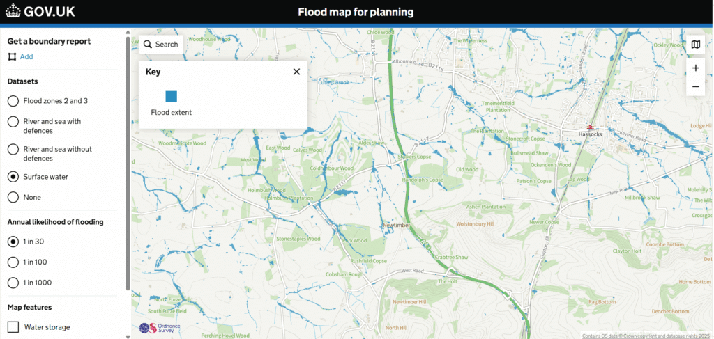
The Environment Agency’s Flood Map for Planning (FMfP) also now shows surface water datasets, further highlighting its importance and relevance.

Flood map for planning showing surface water datasets.
Case Study: Mid Sussex District Council Flood Risk Assessment
Overview
In November 2024, Aegaea supported a planning application for an extension to an existing dwelling in Haywards Heath.
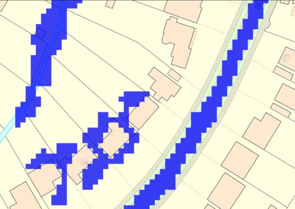
The Mid Sussex District Council (MSDC) Drainage Team initially raised concerns that the proposed extension was located within the 1 in 30 year pluvial flood extent, based on the older Risk of Flooding From Surface Water (RoFSW) dataset. MSDC advised that they considered pluvial flooding to be equivalent to fluvial and tidal flood zones, stating:
“The Planning Practice Guidance: Flood Risk and Coastal Change was updated in August 2022 and requires all sources of flood risk “to be treated consistently with river and tidal flooding in mapping probability and assessing vulnerability” (of development).
Due to the need to consider all sources of flooding consistently with river flooding, Mid Sussex District Council (in line with West Sussex Lead Local Flood Authority advice) now follow the below table when considering flood risk.


Aegaea’s Approach
In response, Aegaea provided further evidence, including photographs and topographic data, to demonstrate that the proposed extension would be situated above the 1 in 30 year flood extent.
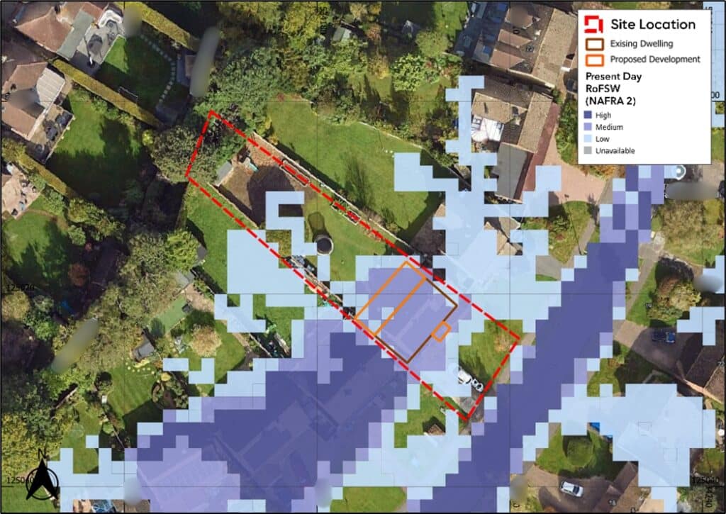
Subsequently, the release of NaFRA2 brought updated surface water flood mapping to the site. According to the January 2025 NaFRA2 data, the site is no longer located within the high-risk (1 in 30 year) flood extent. It is now considered to be at low to medium risk only, both in the present day and under future climate change scenarios.

EA Surface Water Flood Risk Mapping Climate Change Extent. Existing footprint shown as brown outline. Proposed extension shown as orange outline (Base map and data from Google Hybrid © Contains public sector information licensed under the Open Government Licence v3.0)
The Result
The planning application was subsequently approved, taking into account the reduced flood risk shown in the updated mapping and the inclusion of flood resilience measures within the design, as recommended by Aegaea.
This project reflects a broader national trend, and Aegaea has also successfully supported similar applications in other areas where surface water flood risk is a key planning consideration, including London boroughs such as Enfield and Harrow.
Experts in Flood Risk Assessments for Mid Sussex and sites at risk of flooding from surface water
Get in touch with our expert team to discuss how we can support your project, from site-specific flood risk assessments to sustainable drainage design and strategic advice in line with the latest national and local policy updates. We have a number of our team based in the South East, exclusively to Sussex and Kent.
About the Author
Request your free, expert quote now
Aegaea work alongside home owners, private developers, planning consultants, architects, local authorities, international development agencies and contractors. Aegaea know exactly how to help you.


